
Miami Transportation Guide: Cars, Transit and Commutes
Can you live in Miami without a car? Compare transit, driving and daily commutes to choose a home that works with your routine.

2.10.2026

31 minutes

October 5, 2026
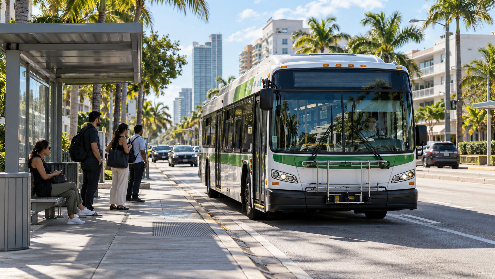
Start With Your Addresses, Destinations, and Daily Schedule
Miami transportation combines County rail and buses, municipal trolleys, regional trains, private intercity rail, and a road network with substantial toll infrastructure. Whether you need a car depends on your exact home, work, and school destinations, service hours, transfers, and everyday errands. The City of Miami and Miami-Dade County are different geographies, and neither can be evaluated through a single commute estimate.
At Bonadomus, we approach transportation as part of evaluating a property. A station nearby is useful when it connects to the places you actually visit, at the times you need to travel. Our starting point is an address-to-address comparison that includes parking, walking, waiting, and the return trip.
U.S. Census Bureau QuickFacts reports mean travel times to work of 27.3 minutes for City of Miami workers and 30.9 minutes for Miami-Dade County workers for 2020-2024. Separately, the 2024 American Community Survey shows that approximately 58.3% of City workers drove alone and 7.7% used public transportation. These statistics describe populations and historical commuting patterns; they do not predict your journey.
Dates matter throughout this guide. Metro Express BRT launched in October 2025, MetroConnect became paid and weekday-only in February 2026, Metrobus schedules changed in July 2026, and applicable Tri-Rail fares increased 10% on October 1, 2026. The operating details below reflect the supplied agency information for this October 2026 guide and remain subject to change; confirm live fares, schedules, and alerts before relying on them.
This guide covers the following transportation decisions:
- Understanding operators, geography, and the car-ownership decision.
- Using Metrorail, Metromover, buses, trolleys, and airport connections.
- Comparing regional rail, driving, tolls, and payment options.
- Interpreting commute statistics and testing a property's actual access.
How Separate Operators Shape Miami Public Transportation
Miami public transportation involves several operators with separate service areas, payment rules, and schedules. Miami-Dade County runs the principal County transit services, the City of Miami operates its trolley, SFRTA operates Tri-Rail, and Brightline operates private intercity trains. A connection on a map does not establish a shared fare or a coordinated departure.
Miami-Dade County's Department of Transportation and Public Works, usually abbreviated DTPW, oversees Metrorail, Metromover, Metrobus, Metro Express BRT, and MetroConnect. These services perform different jobs: rail connects major corridors, Metromover distributes riders around the urban core, buses extend coverage, and MetroConnect handles eligible trips within designated zones.
The operator determines where you check disruptions and how you pay. A County transit alert will not necessarily explain a municipal trolley detour or a Brightline ticket restriction. For a journey involving several systems, save each operator's relevant schedule and identify which leg has the least frequent service.
City of Miami, Miami-Dade County, and South Florida
The City of Miami is a municipality within Miami-Dade County. Miami Beach, Coral Gables, and other municipalities have separate local governments, while some addresses fall in unincorporated County areas. A postal address containing "Miami" does not establish eligibility for a City-operated circulator.
That distinction matters when comparing Miami Beach multi-family properties with properties on the mainland. Identify the municipality, bridge or causeway route, and available bus connections for each address. Do not assume the City of Miami Trolley crosses municipal boundaries to serve a property.
South Florida travel extends into Broward and Palm Beach counties. Tri-Rail and Brightline connect parts of this larger region, but the final station-to-destination segment can determine whether a cross-county commute is practical. Countywide averages and City-only commute statistics cannot describe that entire regional journey.
Compare Services Before Comparing Properties
The figures below are planning references from the agency information used for this guide, rather than live departure information. Frequencies depend on route, direction, time, and disruptions; an operating window does not mean every station offers departures throughout that entire window.
| Mode and operator | Coverage | Standard fare | Hours and frequency | Useful role |
|---|---|---|---|---|
| Metrorail, Miami-Dade | Dadeland, central and northwest County, MIA | $2.25 | Listed 5 a.m. to midnight; line-specific schedules | Corridor commuting |
| Metromover, Miami-Dade | Downtown, Brickell, Omni | Free | Listed 5:30 a.m. to 10 p.m.; approximately 90 seconds at rush hour and 3 minutes off-peak | Urban-core circulation |
| Metrobus, Miami-Dade | Routes across much of the County | $2.25 | Route-specific hours and headways | Destinations beyond rail |
| Metro Express BRT, Miami-Dade | South Dade TransitWay | $2.25 | Check Routes 601 and 602 separately | South Dade connections |
| MetroConnect, Miami-Dade | Designated zones | $3.75; $1.50 for qualifying hub-linked trips | Weekdays, 6:30 a.m. to 7 p.m.; on-demand availability | Eligible local connections |
| Trolley, City of Miami | Municipal routes | Free | Varies by route and day | Short trips and transit connections |
| Tri-Rail, SFRTA | Miami-Dade, Broward, Palm Beach | Use current fare calculator | Train-specific weekday and weekend timetables | Regional commuting |
| Brightline, private operator | South Florida and Orlando | Dynamic ticket pricing | Departure-specific schedules | Regional and intercity travel |
Do You Need a Car in Miami for Your Particular Routine?
A low-car routine can work when home and recurring destinations connect through useful transit routes during operating hours. A car becomes more valuable when destinations are scattered, shifts end late, or several transfers make essential trips difficult. The decision should cover a complete week, including errands and return journeys.
Consider a hypothetical home and office both within practical walking distance of Metromover stations. That pairing may support a transit-based workday without paid rail fares. If the same person regularly returns after the listed 10 p.m. closing time, the transportation budget also needs a dependable evening alternative.
A Health District job near the Green Line creates another potentially workable rail pairing. The test is whether the home connects efficiently to that line and whether the shift aligns with service. A short station-to-station trip can become inconvenient when access to the first station requires an infrequent feeder bus.
When comparing Miami condos, we treat the station entrance, building entrance, parking arrangement, and daily destinations as separate variables. A listing's neighborhood name cannot establish walking access. The route may involve a long block, several crossings, or a building exit that faces away from the station.
Car ownership often becomes more useful for combinations such as these:
- School or care-related trips followed by work at a separate destination.
- Frequent multi-stop errands involving bulky purchases or equipment.
- Late shifts that extend beyond the relevant rail, trolley, or microtransit schedule.
- Cross-county travel with difficult station connections at either end.
One vehicle can be a practical middle ground where one person has a reliable transit commute and another needs flexible travel. Test scheduling conflicts before assuming a second vehicle is unnecessary. Occasional rideshare trips, rentals, or deliveries should appear in the comparison rather than being treated as free substitutes.
Compare full costs on both sides. Car ownership includes financing or depreciation, insurance, maintenance, registration, fuel or charging, tolls, and parking. A transit-based budget includes passes, station parking where applicable, occasional alternative rides, and employer subsidies.
The 2024 City figure of 58.3% driving alone provides context, not a verdict. It measures commuting among workers in that geography, rather than vehicle ownership or all daily travel. Your exact combination of addresses can support a different choice.
Where Miami Metrorail Connects Homes With Daily Destinations
Miami Metrorail is an approximately 25-mile elevated rail system connecting Dadeland and Kendall-area access points with South Miami, Coral Gables, Downtown, the Health District, Hialeah, northwest Miami-Dade, and Miami International Airport. County information lists a $2.25 standard fare and service from approximately 5 a.m. to midnight daily. The line, direction, and day determine whether a transfer is necessary.
The Green Line runs between Palmetto and Dadeland South. On weekdays, the Orange Line provides airport service, with airport-bound riders approaching from the south able to use the appropriate Orange Line train. Riders starting north of Earlington Heights must transfer there for the airport.
Weekend airport travel follows a different pattern. The Orange Line operates as an Airport Shuttle between Earlington Heights and MIA, with the supplied County schedule describing departures every 15 minutes. All airport-bound Metrorail riders then change at Earlington Heights.
Regional connections also need attention. Historic Overtown/Lyric Theatre provides access toward Brightline at MiamiCentral, while Tri-Rail connections are available at the airport station complex and the Tri-Rail/Metrorail Transfer location. These are connections between services, and the walking path and next departure remain part of the trip.
For buyers evaluating Coconut Grove real estate, the useful question is how the particular address connects to a relevant Metrorail entrance. Neighborhood-wide proximity is too imprecise. Compare the actual sidewalk route, feeder service if needed, and distance from the destination station to work.
Frequency should be checked for the train you need, rather than inferred from the number of trains visible on a shared section. Secondary schedule summaries have described roughly 10-minute peak headways, with longer gaps outside peak periods. Use the current County timetable for planning because branch service and maintenance can change that experience.
Single-tracking is especially important. During maintenance, trains traveling in both directions may share one track, altering normal schedules and increasing waits. A live arrival prediction and a service alert together provide more useful information than a saved route screenshot.
Our property comparison therefore separates three measurements: reaching the platform, traveling on the correct train, and completing the final walk. A home near Metrorail becomes substantially more useful when the destination also has a straightforward connection. Rail access at only one end leaves the main practical question unresolved.
How Miami Metromover Supports Short Trips in the Urban Core
Miami Metromover is a free automated people mover serving Downtown, Brickell, and the Omni area through 21 stations on approximately 4.4 miles of infrastructure. County information lists three loops and operating hours of 5:30 a.m. to 10 p.m. daily. It can make short urban trips easier, provided both ends fall within practical station access.
The Omni, Inner, and Brickell loops connect destinations including the Financial District, Kaseya Center, Bayside Marketplace, Miami Dade College, and the School Board area. Transfers to Metrorail are available at Government Center and Brickell. Metromover and Metrorail are distinct systems despite their similar names. To see how this part of the city could fit your daily routine, explore the guide to living in Brickell.
People searching for "Miami metro mover" generally mean this free service. The County describes arrivals approximately every 90 seconds during rush hours and every three minutes off-peak, although disruptions can alter those intervals. Check the loop serving your destination instead of boarding solely because a vehicle arrives quickly.
Metromover access deserves an address-level check when considering Edgewater Miami real estate. A nearby district name does not establish a short walk to an operating station. Compare the official station address list with the building's pedestrian entrance and the crossings between them.
The equipment upgrade program can bring temporary loop closures and replacement shuttle buses. That changes boarding locations and the amount of time spent at street level. Before an appointment, inspect current notices rather than assuming the usual elevated route is operating.
Accessibility also belongs in the route test. The County describes backup accessible service within 30 minutes of a request when a station elevator is unavailable. Treat that as an agency service provision to confirm, rather than a guarantee about the total duration of your journey.
The listed 10 p.m. closing time is a meaningful boundary for a car-light routine. A dinner, event, or work shift may end after the service window even when the outbound ride was straightforward. Price the return alternative before using free daytime transportation to justify a lower monthly travel budget.
How Miami Metrobus, BRT, and MetroConnect Extend Coverage
Miami Metrobus reaches many destinations outside the rail network, while Metro Express BRT serves the South Dade TransitWay and MetroConnect handles eligible zone-based trips. Frequency, transfers, and operating hours determine their usefulness for a specific home. A nearby stop alone provides little information about a dependable daily commute.
Miami-Dade's 2023 Better Bus Network redesign increased the number of frequent routes from five to nineteen, according to the County. It also increased the reported population within 15 minutes of frequent weekday transit from approximately 380,000 to 814,000. These are network-design measures, rather than promises about an individual rider's door-to-door travel time.
For a property comparison, read the actual route timetable in both directions. A stop served every 30 or 60 minutes creates different scheduling constraints from one with frequent service. The return direction may use another street, and evening or weekend service may be substantially different.
This is particularly relevant when evaluating Midtown Miami real estate. Identify which route reaches your destination, whether a transfer is necessary, and where the return stop sits relative to the building. Several nearby bus routes can still leave a particular commute awkward.
Miami-Dade published Metrobus service adjustments effective July 20, 2026. Older relocation guides and saved maps may therefore describe a route pattern or frequency that has changed. Use current timetables, real-time arrivals, and detour notices together.
Read a bus route through three separate questions:
- Does the route serve both destinations directly, or require a connection?
- What are the scheduled gaps at the exact outbound and return times?
- What happens if the first bus is delayed or the connection is missed?
Metro Express BRT on the South Dade TransitWay
Metro Express BRT launched on October 27, 2025, along the approximately 20-mile South Dade TransitWay. County information identifies 14 BRT stations between SW 344th Street and Dadeland South. At Dadeland South, riders can continue north on Metrorail.
Route 601 serves the BRT stations, while Route 602 provides local service along the corridor. Their stopping patterns matter when estimating station access and total travel time. July 2026 adjustments affected service, so check the relevant route rather than applying one frequency assumption to both.
For a home search in Homestead, Cutler Bay, or elsewhere in South Dade, BRT adds a corridor option worth testing. The complete trip includes reaching the TransitWay, waiting for the bus, transferring at Dadeland South if necessary, and leaving the final station. The approximately 20-mile corridor length does not establish a commute duration.
Metro Express uses the standard $2.25 County fare and applicable County payment and transfer rules. Compare its entire journey with the driving alternative, including parking and tolls where relevant. A useful transit connection can change the comparison even when the household keeps a car.
MetroConnect's Paid, Weekday-Only Service
MetroConnect changed substantially on February 1, 2026. The County's January 2026 service-change notice establishes weekday operation from 6:30 a.m. to 7 p.m., a $3.75 standard trip fare, and a $1.50 fare for qualifying trips linked to eligible transit hubs. Older County descriptions calling the service free are outdated.
MetroConnect operates within designated zones and is not a general door-to-door service. Some former zones were discontinued, and pickup and drop-off generally must both fall within the applicable zone. Check the current boundary and designated pickup instructions for the exact trip.
An address close to a zone boundary should receive particular attention. A short geographic distance can still place a destination outside eligibility. Likewise, a qualifying outbound connection does not establish that an evening return after 7 p.m. is available.
Because it is on-demand, booking and pickup availability also affect practical use. Test the service during the period you expect to travel. Include an alternative for weekends, late returns, or trips that fall outside the current rules.
Where the City of Miami Trolley Fits Into a Daily Route
The Miami Trolley is a free City of Miami municipal service used for neighborhood circulation and connections to other transportation. Routes serve areas including Brickell, Coconut Grove, Coral Way, Little Havana, Wynwood, Allapattah, Little Haiti, the Health District, and Overtown. Hours vary by route and day, and coverage is not countywide.
For short trips, a trolley can reduce the distance walked to a station or another destination. Its value depends on the direction of the route, stop placement, and actual arrival time. A route that loops through several streets may take longer than the map distance suggests.
When comparing Wynwood Miami real estate, assess trolley access using current stop locations and the specific destination you need to reach. An advertised nearby trolley stop should lead to questions about hours and connections. It should not become a general claim that every daily trip is covered.
Municipal services elsewhere operate under separate rules. Miami Beach and Coral Gables have their own local transportation arrangements, and on-demand services may use different providers or eligibility zones. A familiar vehicle brand or app name does not establish identical service conditions across municipalities.
Use the City of Miami's current Transportation & Roadways portal to find trolley schedules and maps. Archived trolley pages can remain visible in search results after information has moved. Confirm the route and timetable through the current municipal service information.
A trolley connection should also be tested when it feeds a less frequent train or bus. Missing that connection can create a much larger delay than the trolley ride itself. For a time-sensitive commute, identify an alternative walking route or another service before depending on a tightly timed transfer.
How to Reach Miami International Airport Without Driving
Miami International Airport is accessible through Metrorail, several Metrobus routes, and Tri-Rail via the Miami Intermodal Center. Weekday Metrorail airport service differs from weekend service, when passengers transfer at Earlington Heights to the Airport Shuttle train. Your flight time and the final terminal connection determine whether transit is practical.
On weekdays, airport-bound riders approaching from the south use the appropriate Orange Line service. Riders coming from north of Earlington Heights transfer there on any day. On weekends, the supplied County schedule describes an Airport Shuttle between Earlington Heights and MIA every 15 minutes.
For passengers starting in Broward or Palm Beach County, Tri-Rail's Miami Airport station provides a regional option. Plan the complete connection from the rail station through the airport access facilities to the relevant terminal. Arriving at a station bearing the airport's name is not the same as reaching airline check-in.
Test the trip under realistic conditions. Walking a connection with luggage can take longer than walking it during an ordinary commute, and elevator availability can alter the route. Include the airline's recommended arrival margin separately from the transportation estimate.
- Check the first usable departure for an early flight.
- Check the last practical connection after an evening arrival.
- Allow for baggage collection and terminal circulation on the return trip.
- Keep a backup plan for delays extending beyond transit operating hours.
A route that works well for a midday departure may fail for an early-morning flight. We therefore treat airport access as its own property-location test. It should not be inferred from the success of a weekday office commute.
How Tri-Rail and Brightline Serve Different Regional Trips
Tri-Rail is public commuter rail operated by the South Florida Regional Transportation Authority, while Brightline is private intercity rail. Both connect parts of South Florida, but their tickets, stopping patterns, and schedules differ. Neither should be treated as included automatically in a Miami-Dade transit fare.
SFRTA describes Tri-Rail's main corridor as 73.5 miles with 19 stations across Miami-Dade, Broward, and Palm Beach counties. MiamiCentral service introduces an additional routing consideration that must be checked against the current timetable. Brightline connects MiamiCentral with Aventura, Fort Lauderdale, Boca Raton, West Palm Beach, and Orlando. If you are considering Broward, compare life and the housing market in Fort Lauderdale to connect your housing search with everyday travel needs.
Regional access matters when comparing South Florida condos across county lines. Measure travel to the departure station and from the arrival station to the actual destination. A convenient intercity train can still leave a difficult daily connection at one end.
Tri-Rail for Cross-County Commuting
Tri-Rail's Miami-Dade stops include Miami Airport, Hialeah Market, Metrorail Transfer, Opa-locka, Golden Glades, and MiamiCentral service. Many MiamiCentral journeys require a change at Metrorail Transfer Station unless a designated express train covers the trip. Read the itinerary for the specific departure rather than assuming every train continues Downtown.
SFRTA's fare-change announcement states that applicable fares increased 10% effective October 1, 2026. Use the current fare calculator and pass information when building a relocation budget. Older tables can understate recurring costs.
The most useful test is a complete working day. Check arrival before the required start time, a realistic departure after work, and the next option if a meeting runs late. A schedule that fits only one narrowly timed train can create recurring pressure.
Employer benefits may affect the economics. The University of Miami, for example, describes discounted Tri-Rail passes for eligible faculty and staff. Ask your own employer about eligibility, payroll arrangements, and whether a benefit can be combined with another transportation program.
Parking and feeder travel should remain separate line items. A rail pass alone does not represent the full monthly cost if you drive to a station or need another paid service after arrival. Verify weekend schedules independently if the same route must support nonwork trips.
Brightline for Regional and Intercity Journeys
Brightline is privately operated intercity rail, rather than Miami-Dade public transit. Its MiamiCentral location connects with the surrounding local network, including Metrorail access through Historic Overtown/Lyric Theatre. Allow time for the walk between services and any boarding requirements.
Brightline's supplied Orlando service information describes Miami-Orlando travel of approximately three hours and 30 minutes and a schedule of 16 daily round trips between Central and South Florida. Those figures are operator descriptions subject to change. They do not include reaching the station or completing the trip after arrival.
Ticket prices are dynamic, so a fare found for one departure should not become a fixed monthly commuting assumption. Price the dates and times you would actually use. If considering a commuter product, verify its current availability, restrictions, and usefulness for the required stations.
For occasional regional meetings or intercity trips, Brightline may provide an alternative to driving. Its value depends on the entire itinerary and ticket cost. Keep that occasional-travel calculation separate from the household's routine County transit budget.
What Driving in Miami Adds to Your Housing Budget
Driving provides flexibility across Miami-Dade, but the practical cost includes tolls, parking, and time spent reaching major roads. The network includes interstates, expressways, toll facilities, and optional express lanes. Those lanes may improve predictability under some conditions, without guaranteeing a particular arrival time.
The major corridors serve different travel patterns. I-95 is a principal north-south route, while I-195 and I-395 provide east-west connections toward Miami Beach. SR 826, the Palmetto Expressway, and SR 836, the Dolphin Expressway, support other major County movements; Florida's Turnpike and US 1 are important for many suburban and South Dade trips.
The useful corridor depends on the address and destination. Distance to an interchange is only one part of access because local streets, turning restrictions, queues, and the direction of entry also matter. Test the actual entrance and exit you would use.
For Miami townhouses, compare assigned parking, garage access, guest parking rules, and the route out of the development. A convenient highway location does not establish that two vehicles fit the property's parking arrangements. Verify those details in the applicable documents.
Workplace requirements also change the calculation. Someone evaluating businesses for sale in Miami alongside a relocation may need to test opening-hour access, supplier visits, and travel between multiple sites. A conventional morning commute estimate would leave those transportation needs unmeasured.
Recurring tolls belong in the monthly budget. Record the outbound and return route, the number of commuting days, and whether express-lane use is occasional or routine. Dynamic charges should be treated as variable expenses rather than represented by a single quoted toll.
Parking can be equally decisive. Confirm the cost and availability at both ends, plus any waiting time associated with controlled garages or valet arrangements. The drive ends when you reach the destination, not when the navigation app reaches the building frontage.
Setting Up SunPass and Electronic Tolling
SunPass is Florida's prepaid toll program and generally offers lower toll rates than TOLL-BY-PLATE. Many facilities collect tolls electronically. The payment rules for express lanes are more restrictive than those for ordinary toll-road travel.
FDOT states that Florida express lanes require an active, properly mounted SunPass or another interoperable transponder. They accept neither cash nor TOLL-BY-PLATE. Confirm compatibility and account status before entering rather than assuming a license-plate invoice will resolve payment.
- Register the correct vehicle and license plate with the applicable account.
- Install the transponder according to its instructions.
- Check account funding and any automatic replenishment settings.
- Review rental-car toll policies before using a personal transponder in a rental.
Rental companies may apply their own toll-program fees and procedures. Clarify those terms before a temporary vehicle becomes part of your moving plan. Also review statements after a vehicle or plate change to catch account mismatches promptly.
How to Budget for Miami-Dade Transit Fares and Transfers
The County's February 2026 fare guide lists a $2.25 standard fare for Metrobus, Metrorail, and Metro Express BRT, while Metromover is free. MetroConnect uses its separate $3.75 standard and $1.50 qualifying hub-linked fares. Payment method, transfer timing, and pass eligibility affect the total cost of a journey.
Metrorail fare gates do not accept cash directly. County information lists contactless payment, EASY Card, EASY Ticket, and supported mobile passes through the GO Miami-Dade Transit app. Ticket vending machines accept cash for purchasing an EASY Card or EASY Ticket.
Available mobile products include One-Trip, One-Day, and Seven-Day options through supported platforms such as Token Transit. Monthly products may suit frequent travel, but their value depends on current prices and how often you actually ride. Check product validity and activation instructions before purchasing.
Transfers require particular care. Do not assume every second boarding is free or that switching between payment methods preserves a transfer entitlement. Review the County's current transfer rules for the services, payment instrument, and interval involved.
For budgeting, separate these categories:
- Routine paid boardings and the pass that covers them.
- Additional operators requiring separate tickets.
- Station parking or feeder-trip charges.
- Alternative rides when transit is unavailable.
- Employer contributions and verified fare discounts.
Miami-Dade offers programs including Golden Passport, Patriot Passport, Commuter Reduced Fare, and disability-related fares. Each has eligibility and application requirements. Treat a reduced fare as available only after confirming that the rider qualifies and has completed any required enrollment.
Employer subsidies can materially affect the car-versus-transit comparison. University of Miami transportation information, for example, describes discounted products for eligible students and employees. Ask human resources about current benefits rather than assuming the same arrangement applies across employers.
Tri-Rail and Brightline retain separate fare systems. A County pass should therefore never be budgeted as a universal South Florida travel pass. Price each operator in the actual itinerary, then compare the complete monthly total.
Why the First and Last Mile Can Decide Whether Transit Works
Transit access depends on the route between your door and the station as much as the ride itself. Walking conditions, crossings, weather, bicycle storage, and feeder-service hours can determine whether an apparently short connection works every day. Miami's walkability varies by block and destination.
Test the pedestrian route at the intended commute time. Note shade, pavement continuity, signalized crossings, lighting, and exposure to rain. A distance that feels comfortable during a property viewing may feel different while carrying work equipment in hot weather.
County information describes bicycle racks at Metrorail stations and on Metrorail cars, along with free BikeLids at designated locations on a first-come, first-served basis. Confirm the facilities at the station you plan to use. Availability of a particular storage space should not be assumed.
Other first-mile and last-mile options include municipal trolleys, eligible MetroConnect trips, bicycle-share or scooter services where currently offered, and Park & Ride facilities. Each introduces its own rules and availability constraints. Check parking fees, service zones, return requirements, and operating hours separately.
For a drive-to-transit routine, the station parking process belongs in the timed trial. Measure the walk from the actual parking area to the platform and the return process in the evening. A convenient road connection can lose its advantage if parking access is cumbersome.
The same objective approach applies when assessing Miami Beach commercial real estate as a daily destination. Examine pedestrian access, delivery needs, parking, and available transit connections rather than assigning a broad walkability label to the entire municipality.
About 4.1% of City of Miami workers walked to work in the 2024 ACS dataset. That describes work travel among City residents, not sidewalk quality or access to every destination. For your property decision, a real walk along the proposed route is more informative than that citywide percentage.
What Miami Commute Times Reveal, and What They Cannot Predict
U.S. Census Bureau QuickFacts reports a 2020-2024 mean travel time to work of 27.3 minutes for the City of Miami and 30.9 minutes for Miami-Dade County. These historical statistical averages describe different resident populations and mix many routes and travel modes. They are not route-specific forecasts or promised journey times.
The City of Miami QuickFacts estimate applies to workers age 16 and older who traveled to work in that municipality's resident population. The Miami-Dade County estimate covers the broader County population. These are residence-based measures, not averages for everyone traveling to jobs inside each boundary.
The observation period matters. The 2020-2024 five-year estimates combine several years, including pandemic-era commuting patterns. They should not be described as a live traffic reading or compared casually with a single journey observed in 2026.
How City of Miami Residents Travel to Work
The 2024 ACS one-year Table B08301 reports 265,512 City of Miami workers in its commuting-mode dataset. Driving alone was the largest category, while working from home represented a substantial separate share. The table below shows selected categories, with percentages calculated from the reported counts and rounded.
| Commute category | Workers | Share of City workers |
|---|---|---|
| Drove alone | 154,864 | 58.3% |
| Worked from home | 41,627 | 15.7% |
| Carpooled | 22,414 | 8.4% |
| Public transportation | 20,372 | 7.7% |
| Walked | 10,755 | 4.1% |
Source: U.S. Census Bureau, 2024 ACS one-year estimates, Table B08301, City of Miami. These selected categories do not sum to 100% because other transportation categories are omitted. The dataset covers commuting, rather than school trips, errands, airport journeys, or weekend travel.
Working from home also requires careful interpretation. Those workers appear in the means-of-transportation dataset, but they do not contribute a zero-minute journey to the travel-time mean for people commuting to work. The one-year mode shares and five-year travel-time estimates should remain clearly labeled as different measures.
Why Your Commute Requires a Separate Test
An average combines short local trips with longer journeys across the County. It does not tell you how many transfers a specific public transportation commute requires or how long a parking queue lasts. Departure time, destination, direction, and travel mode determine the experience.
For transit, measure access walking, waiting, in-vehicle travel, transfers, and the final walk. For driving, include congestion, incidents, construction, toll-lane choices, and parking. The full journey can differ considerably from the time shown for its longest segment.
We do not use an unexplained "minutes to Downtown" claim as a reliable property-comparison metric. Downtown has many destinations, and a quiet-period drive says little about an arrival required during peak traffic. A useful estimate identifies the endpoints, departure time, mode, and observation date. For a comparison of urban living and housing options, see the Downtown Miami neighborhood guide.
Record a range across several trials and identify what produced the slower trips. One missed connection may matter more than a modest difference in typical travel time. Your decision should reflect both the usual journey and whether the less convenient days remain manageable.
How to Test a Commute Before Choosing a Home
Test exact home-to-work, home-to-school, and recurring errand routes before committing to a property. Use current traffic tools, GO Miami-Dade Transit planning, real-time arrivals, service alerts, and accessibility information, then repeat the journey under realistic conditions. The result should be a documented range of time and cost for each shortlisted address.
1. List Every Recurring Destination
Start with street addresses and required arrival times for everyone using the transportation plan. Include work, school, appointments, shopping, and regular evening activities. Note which trips must happen together and which can move to another time.
Distinguish essential trips from occasional preferences. A frequent destination with no workable return service can affect the entire car-ownership decision. A once-monthly trip may be handled through a separately budgeted alternative.
2. Compare Realistic Departure Windows
Run driving and transit options for weekday mornings, evening returns, and relevant weekend periods. Save the date, route, predicted duration, and service assumptions. Repeat on different days instead of selecting the most favorable result.
Include a delayed departure scenario. Meetings, appointments, or errands can cause you to miss the planned train. Check whether the next option adds a modest wait or makes the entire trip impractical.
3. Inspect Transfers and Physical Access
Count every transfer and walk, including movement between platforms and neighboring stations. Check elevator and escalator status where those facilities are necessary. Confirm the final usable service for the return journey rather than relying on the network's general closing time.
For MetroConnect or a municipal on-demand service, verify both trip endpoints and service eligibility. For a trolley, verify direction and stop location. A route planner's suggestion should be checked against the operator's current rules.
4. Price the Complete Transportation Plan
Build monthly totals for passes, additional tickets, tolls, parking, and alternative rides. Add vehicle ownership costs if comparing one car with two cars or no car. Apply employer benefits only after confirming eligibility and current terms.
5. Complete a Live Trial
Take the actual ride or drive before signing when practical. Start at the property entrance and finish at the real destination entrance. For a remote purchase, identify which parts remain untested and arrange an on-the-ground review rather than presenting a digital estimate as observed experience.
At Bonadomus, this framework supports objective property and location comparisons. We can help organize questions about station access, parking, roads, and available services alongside the wider property evaluation. The assessment follows your stated destinations and transportation priorities, without neighborhood labels based on who should live there.
What to Confirm Before Your First Week in Miami
Before moving, confirm the operators serving your address, set up payment methods, and save the schedules you will actually use. Then verify parking, toll arrangements, airport access, and backup routes. These checks reduce avoidable problems during the first weeks in a new home.
- Address jurisdiction: Identify the municipality and County services covering the property.
- Nearest useful stop: Record the station entrance or bus stop, travel direction, and walking route.
- Frequency: Check weekday peak, evening, and weekend schedules separately.
- Transit payment: Set up an appropriate EASY Card, contactless method, or supported mobile product.
- Live information: Install GO Miami-Dade Transit where useful and save each additional operator's alerts.
- Toll account: Confirm the transponder, plate registration, balance, and rental-car policy where applicable.
- Parking: Verify home, workplace, visitor, and station arrangements, including any recurring charges.
- Airport travel: Check an early departure and a late return, with luggage and terminal access included.
- Regional rail: Verify Tri-Rail transfers and current fares, or Brightline tickets for intended departures.
- Benefits: Confirm employer subsidies and approved reduced-fare eligibility.
- Backup plan: Identify alternatives for a missed connection, service closure, or unavailable vehicle.
Review the plan again after the first week of actual travel. Replace assumptions with observed waiting times, parking costs, and walking conditions. Keep the dates beside saved schedules, especially after the 2025-2026 BRT, MetroConnect, Metrobus, and Tri-Rail changes.
Test your actual work, school, and daily-trip routes using current transit and traffic tools, then discuss your property search with Bonadomus for objective location guidance based on your transportation priorities.
Choose a Home Around Tested Transportation Access
A workable transportation plan starts with exact destinations, realistic travel times, and a complete cost comparison. Some Miami addresses support daily transit use, while others make a car more practical. Service hours, transfers, station access, parking, and tolls determine which arrangement fits a particular routine.
Keep the operators and geographies separate. City of Miami trolleys, Miami-Dade transit, SFRTA's Tri-Rail, and private Brightline services have different coverage and payment rules. A connection between them requires its own schedule and cost check.
The Census means of 27.3 minutes for City of Miami workers and 30.9 minutes for Miami-Dade County workers describe the 2020-2024 period. They provide background about commuting, not an estimate for a specific property. Your route trial should produce a realistic range rather than a promised arrival time.
Finally, treat transportation information as dated information. MetroConnect's paid weekday service and Tri-Rail's October 2026 fare increase illustrate how quickly an older guide can become misleading. A property decision supported by current schedules, verified parking arrangements, and tested journeys gives you a clearer understanding of daily life and recurring costs.
Do you need a car in Miami if you live near Metrorail or Metromover?
There is no universal answer. It depends on whether your exact home, work, school, and errand destinations connect through useful routes during the hours you actually travel. A station near home helps only if the destination end also has a straightforward connection and the last usable return service fits your schedule. For example, Metromover's listed hours end at 10 p.m. Test a full week of trips, including the cost of backup rides, before deciding against owning a car or a second vehicle.
What changed with Miami-Dade MetroConnect in 2026?
Since February 1, 2026, MetroConnect has been a paid, weekday-only microtransit service operating from 6:30 a.m. to 7 p.m. According to the County's January 2026 service-change notice, the standard trip costs $3.75, and qualifying trips linked to eligible transit hubs cost $1.50. Some former zones were discontinued, and pickup and drop-off generally must both fall inside the same designated zone. Older County material describing the service as free is outdated.
How do you get to Miami International Airport by Metrorail on weekends?
On weekends, all airport-bound Metrorail riders transfer at Earlington Heights to the Orange Line Airport Shuttle, which the County schedule describes as running every 15 minutes to MIA. On weekdays, riders coming from the south can use the appropriate Orange Line train directly, while riders from north of Earlington Heights transfer there on any day. Check the first and last practical departures for your flight and allow extra time for luggage and the walk to the terminal.
Can a Miami-Dade transit pass be used on Tri-Rail or Brightline?
Do not budget a County pass as a universal South Florida pass. Tri-Rail is public commuter rail run by SFRTA with its own fare system, and applicable fares rose 10% on October 1, 2026. Brightline is a private intercity operator with dynamic ticket pricing, not part of Miami-Dade public transit. Price each operator in your actual itinerary separately and check employer benefits, such as discounted Tri-Rail passes some employers offer.
Why don't average Miami commute times predict how long your commute will take?
Census QuickFacts reports mean travel times to work of 27.3 minutes for City of Miami workers and 30.9 minutes for Miami-Dade County workers, but these are 2020-2024 statistical averages for resident populations. They mix many routes, modes, and years, including pandemic-era patterns. They do not capture your transfers, waiting time, parking, or the direction and timing of your trip. Use them as background and measure your own range through repeated address-to-address trials.
Can you use Florida express lanes without a SunPass?
According to FDOT, Florida express lanes require an active, properly mounted SunPass or another interoperable transponder, and they accept neither cash nor TOLL-BY-PLATE. On ordinary toll roads, SunPass generally offers lower rates than TOLL-BY-PLATE billing. Register the correct vehicle and plate, keep the account funded, and review rental-car toll policies before using a personal transponder in a rental. Because express-lane charges are dynamic, budget them as a variable expense.
How should you test a commute before buying or renting a home in Miami?
List every recurring destination with exact addresses and arrival times, then compare driving and transit for weekday mornings, evening returns, and weekends on several different days. Count every transfer and walk, check elevator status and the last usable return service, and price passes, extra tickets, tolls, parking, and backup rides. Where practical, do a live trial from the property entrance to the real destination entrance. For remote purchases, clearly note which parts remain untested.
- — Start With Your Routes
- — Operators and Service Areas
- — Deciding on Car Ownership
- — Metrorail Routes and Connections
- — Downtown and Brickell Circulation
- — Buses and South Dade
- — Trolleys and Local Circulators
- — Planning Your Airport Trip
- — Regional Rail Choices
- — Roads, Tolls, and Parking
- — Fares and Payment Methods
- — Walking and Station Access
- — Understanding Commute Statistics
- — Test Before You Commit
- — Your Moving Transportation Checklist
- — Choose by Actual Access